Observing biomass burning in Indonesia to improve air quality monitoring
Ground-based measurements of aerosols from the 2019 peat fires in Indonesia will combine with satellite data to improve air quality monitoring.
Challenge
Biomass burning severely pollutes the environment, producing plumes of trace gases, including carbon monoxide, and fine aerosols which pose risks to public health. Satellite data can be used with models and ground based measurements to determine if the air quality is getting worse and help assess the relationship between burning events and climate change. The extent of fire plumes from Indonesia and elsewhere is indicated by carbon monoxide distributions produced from MetOp by RAL Space’s Infrared and Microwave Sounding scheme on the JASMIN computer infrastructure. To exploit satellite observations of aerosol in the plumes, the optical properties of the aerosol need to be understood, starting with inputs from ground measurements of their composition and size distribution.
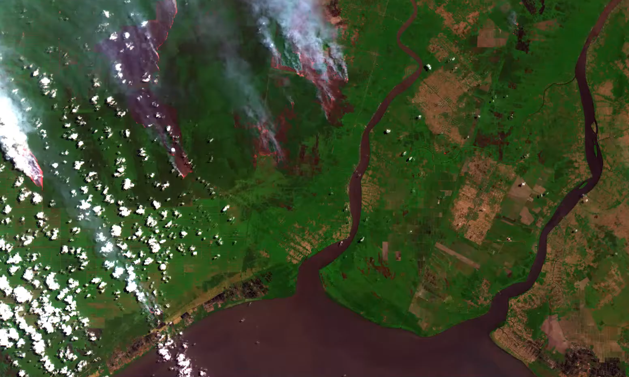
Fires in Borneo, Indonesia, captured by Sentinel-2. Data: Copernicus. Processing: Simon Proud / NCEO / RAL Space
Approach
Scientists from RAL Space Remote-Sensing Group and King’s College London visited Palangkaraya in Indonesia and took measurements on the ground around peatlands, a school and a hospital in September 2019.

